|
Many thanks for permission to use graphics from their software and toposheets |
|
|
18 March 2007 Whatatiri Trackpage 1 Beginning about 150 m up from the car park at the end of Long Road, Whatatiri track runs down through farmland and then bush, fords the Waitakere Stream and finishes at the Cascade Carpark. I used it as a final leg in a loop walk that began at the Cascade Carpark, continued along Auckland City Walk and Upper Kauri Track, along Long Road Track and down Whatatiri to the Cascade Carpark again. I wasn't especially taken by the farm section - much of the track is bordered by dead and rejuvenating sprayed gorse, and personally, I am not a great fan of out in the open walking - though I'll make an exception for a decent bit of South Island river valley with mountains either side. The bush section is pleasant, and for the most part easy going, though I'd check the level of the Waitakere stream after heavy rain. If I wanted to revisit the track for itself, I'd probably start at the Cascade carpark and walk the bush section as far as the bridge and then return the same way.
The carpark is an hour down the track and in the event I make it in 1hr 7 minutes. I had planned to stop for lunch about here, but a persistent light drizzle prompted me to keep moving. You can see for some distance across bush-covered hills, or at least as far as the drizzle permits.
The day is warm, I've been walking a couple of hours already, and with the drizzle, it's exceptionally muggy. Grumpy? Me?
Even if she can't read, Alice is still giving the fence a wide berth. It was up here last year along Long Road that she first discovered electric fences and these are the real thing, not 12 volt apologies. We head downhill on a winding farm road, and across a small bridged stream,
and up the other side. Gripping stuff.
You can see the dead gorse that will be a feature along here for a bit. If it's a serious attempt to deal with it, it'll need more than just spraying it and leaving it as nursery shelter for the next generation of seed, but already along the way you can see it rejuvenating where spraying has not been adequate.
We arrive at a gate, or rather a small collection of gates. The important thing here is to keep going straight ahead.
The pink triangles pointing to the right are not faded red track markers, they are indicators of traps and poison stations aimed at rats, possums and stoats.
The red markers are located on low posts every few hundred metres, and not always easy to see.
As a general rule, follow the fenceline. We continue through the paddocks. The drizzle is intensifying and a few drops find their way onto the UV filter in the front of my camera. More mostly-dead gorse.
The drizzle is easing a little but we're now into some serious dead gorse.
We're getting back into bush now, and with the drizzle the track surface is a touch slippery. But it's a sight more attractive than what we've been through.
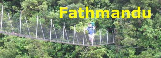
Just ahead is a small bridge and we've effectively reached the bottom of the track. Alice wants to explore the creek and has a splash around and a drink and we continue. Down here the drizzle is pretty much unnoticeable though it's still pretty muggy. There's a couple of foggy patches on my UV filter but I've nothing soft or dry to clean it with.
|
|


